
The ‘1 Nojor’ media platform is now live in beta, inviting users to explore and provide feedback as we continue to refine the experience.
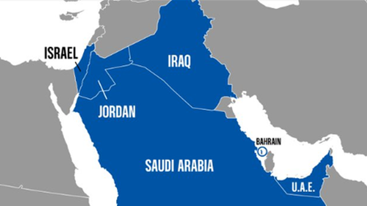
Social media users alleged that a Middle East map published by US Central Command depicted the Gaza Strip and the occupied West Bank as part of Israel. The map accompanied a statement on CENTCOM commander Brad Cooper’s 10-day Middle East trip, according to an Al Jazeera report published on August 16, 2026.
Screenshots circulated online appeared to place Gaza and the occupied West Bank inside Israel’s borders. The issue quickly drew attention from users, with one accusing CENTCOM of doing so deliberately. Russia’s Sputnik also commented that CENTCOM appeared to have made another geographical error, saying the map showed the Gaza Strip and West Bank as Israeli territory.
CENTCOM later appeared to revise the map. When Al Jazeera viewed the statement, the occupied West Bank was shown separately from Israel, although Gaza was not marked as a separate territory. The report also said Palestine is recognized as a sovereign state by 157 of the United Nations’ 193 member states.

The ‘1 Nojor’ media platform is now live in beta, inviting users to explore and provide feedback as we continue to refine the experience.